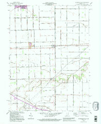
1992 Map of Woodburn South
USGS Topo · Published 1995About this map
The Norfolk and Western railway corridor and the historic Lincoln Highway anchor this agricultural landscape along the Indiana-Ohio border in the early 1990s. The terrain is defined by an extensive drainage network, including Flatrock Creek and dozens of named channels like Anspaugh Ditch and Knoblaugh Ditch, which supported the conversion of this flat till plain into productive farmland. Small communities such as Woodburn, Edgerton, and Townley serve as local hubs for the surrounding townships. Local family names and community landmarks are preserved through features like Sugar Ridge Cem and the Township Sch. This edition includes 1990s-era revisions, highlighting the persistence of small-town infrastructure alongside modern elements like a Radio Tower and Golf Course near Benton.
Find a feature on this map
74 named features on this map. Tap any name to fly to it.
Don’t see what you’re looking for? This feature index may not catch every label — zoom into the map to look around manually.
Map Details
Editions of this 1992 Woodburn South Map
This is the sole edition of this map. No revisions or reprints were ever made.
Other maps of this area

1914 · Van Wert
USGS Topo · 1:62,500

1914 · Paulding
USGS Topo · 1:62,500

1944 · Van Wert
USGS Topo · 1:62,500

1944 · Paulding
USGS Topo · 1:62,500

1953 · Fort Wayne
USGS Topo · 1:250,000

1953 · Muncie
USGS Topo · 1:250,000

1956 · Muncie
USGS Topo · 1:250,000

1956 · Fort Wayne
USGS Topo · 1:250,000

1957 · Maples
USGS Topo · 1:24,000

1958 · Grabill
USGS Topo · 1:24,000