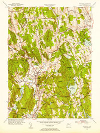
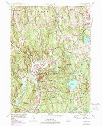
1955 Map of Woodbury
USGS Topo · Published 1956About this map
The Pomperaug River and its tributaries, including the Weekeepeemee River and Nonewaug River, carve through the rolling Litchfield County hills in the mid-1950s. The village of Woodbury serves as a central hub, flanked by the North Woodbury and Hotchkissville settlements. Local institutions such as the Taft Sch and the Regina Laudis Priory are established landmarks, while the landscape is dotted with numerous private ponds like Morehouse Pond and Lake Winnemaug.
Find a feature on this map
87 named features on this map. Tap any name to fly to it.
Don’t see what you’re looking for? This feature index may not catch every label — zoom into the map to look around manually.
Map Details
Editions of this 1955 Woodbury Map
5 editions found
Other maps of this area

1889 · Derby
USGS Topo · 1:62,500

1891 · Derby
USGS Topo · 1:62,500

1892 · Danbury
USGS Topo · 1:62,500

1892 · New Milford
USGS Topo · 1:62,500

1893 · Waterbury
USGS Topo · 1:62,500

1893 · New Milford
USGS Topo · 1:62,500

1893 · Derby
USGS Topo · 1:62,500

1904 · New Milford
USGS Topo · 1:62,500

1904 · Waterbury
USGS Topo · 1:62,500

1904 · Litchfield
USGS Topo · 1:125,000