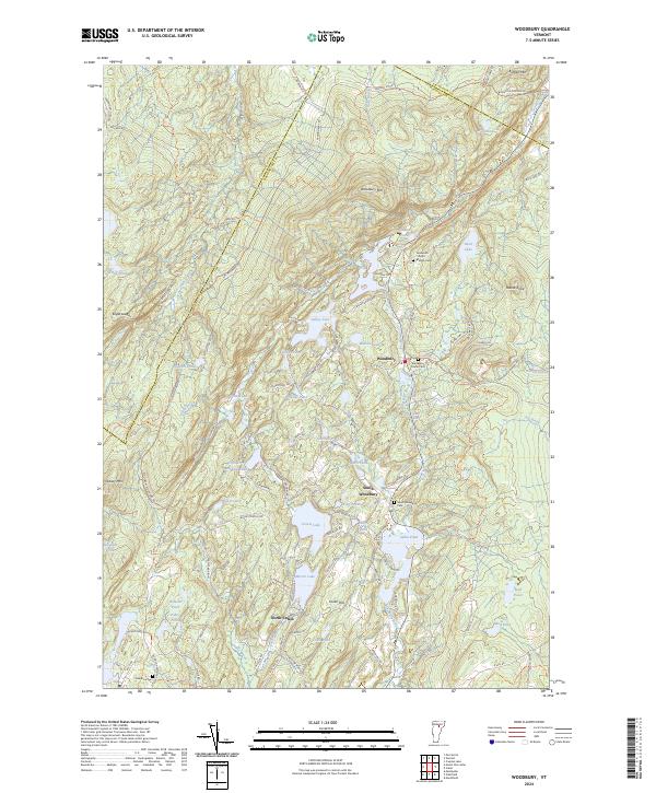
2024 Map of Woodbury
USGS Topo · Published 2024About this map
Woodbury and South Woodbury serve as the primary hubs in this lake-strewn landscape, where a dense network of secondary roads such as Wheeler Hill Rd and Bailey Bridge Rd connects numerous ponds and small settlements. The terrain is defined by significant elevations like Woodbury Mtn and Hobart Mtn, with the northern border meeting Buffalo Mtn. This area is particularly rich in family-named landmarks and cemeteries, including the Ainsworth - North - Bradish Cem and Robinson Cem, providing essential data for genealogical research in this part of Washington County. The presence of Fletcher Quarry Rd and Woodbury Quarry Rd points to the local importance of the stone industry, while water bodies like Valley Lake and Sabin Pond dominate the valleys between the granite-flecked hills.
Find a feature on this map
107 named features on this map. Tap any name to fly to it.
Don’t see what you’re looking for? This feature index may not catch every label — zoom into the map to look around manually.
Map Details
Editions of this 2024 Woodbury Map
This is the sole edition of this map. No revisions or reprints were ever made.
Other maps of this area

1919 · Montpelier
USGS Topo · 1:62,500

1921 · Montpelier
USGS Topo · 1:62,500

1927 · Hyde Park
USGS Topo · 1:48,000

1928 · Hardwick
USGS Topo · 1:62,500

1930 · Hyde Park
USGS Topo · 1:62,500

1934 · Hardwick
USGS Topo · 1:48,000

1938 · Hardwick
USGS Topo · 1:62,500

1939 · Plainfield
USGS Topo · 1:48,000

1940 · Plainfield
USGS Topo · 1:62,500

1943 · Plainfield
USGS Topo · 1:62,500