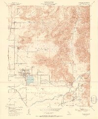
1952 Map of Woodlake
USGS Topo · Published 1953About this map
Woodlake serves as a central hub in this Tulare County landscape, where the agricultural plains meet the foothills of the Sierra Nevada. The town is anchored by Bravo Lake and the Union High School, with the Atchison Topeka and Santa Fe (Visalia) railroad providing a critical link for the region's transport. To the north and west, smaller settlements and stations like Elderwood and Woodlake Junction illustrate the dispersed ranching and farming patterns of the early 1950s.
Find a feature on this map
66 named features on this map. Tap any name to fly to it.
Don’t see what you’re looking for? This feature index may not catch every label — zoom into the map to look around manually.
Map Details
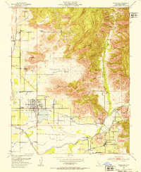
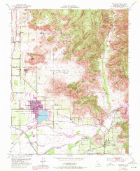
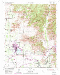
Editions of this 1952 Woodlake Map
4 editions found
Other maps of this area

1903 · Tehipite
USGS Topo · 1:125,000

1904 · Kaweah
USGS Topo · 1:125,000

1905 · Tehipite
USGS Topo · 1:125,000

1909 · Kaweah
USGS Topo · 1:125,000

1921 · Stokes Mountain
USGS Topo · 1:24,000

1922 · Trimmer
USGS Topo · 1:96,000

1924 · Dinuba
USGS Topo · 1:125,000

1924 · Stokes Mountain
USGS Topo · 1:31,680

1925 · Rocky Hill
USGS Topo · 1:31,680

1926 · Ivanhoe
USGS Topo · 1:31,680