1952 Map of Woodlake
USGS Topo · Published 1975About this map
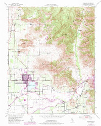
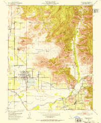
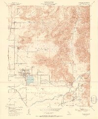
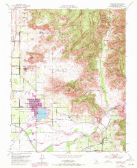
Woodlake serves as the focal point of this Central Valley survey, which details a landscape transitioning from the citrus-growing lowlands to the Sierra Nevada foothills. The map reveals a complex irrigation and transport infrastructure essential to the era's agriculture, featuring the Wutchumna Ditch and Friant Kern Canal alongside the Visalia Electric and Atchison Topeka and Santa Fe railroads. Evidence of early land use is found in named estates like Minnehaha Ranch and Vanderhoof Ranch, while the community of Lemoncove and the Sequoia Union Sch anchor the southeastern portion of the quadrangle. The topography shifts dramatically from the flat expanse of Antelope Valley toward prominent heights such as Antelope Mountain and Davis Mountain, where deep drainages like Hambright Canyon and Dry Creek cut through the foothills. This 1952 edition, with revisions through 1969, preserves the mid-century layout of these agricultural hubs before modern expansion.
Find a feature on this map
59 named features on this map. Tap any name to fly to it.
Don’t see what you’re looking for? This feature index may not catch every label — zoom into the map to look around manually.
Map Details
Editions of this 1952 Woodlake Map
4 editions found
Other maps of this area

1903 · Tehipite
USGS Topo · 1:125,000

1904 · Kaweah
USGS Topo · 1:125,000

1905 · Tehipite
USGS Topo · 1:125,000

1909 · Kaweah
USGS Topo · 1:125,000

1921 · Stokes Mountain
USGS Topo · 1:24,000

1922 · Trimmer
USGS Topo · 1:96,000

1924 · Dinuba
USGS Topo · 1:125,000

1924 · Stokes Mountain
USGS Topo · 1:31,680

1925 · Rocky Hill
USGS Topo · 1:31,680

1926 · Ivanhoe
USGS Topo · 1:31,680