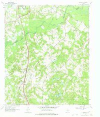
1962 Map of Woodlawn
USGS Topo · Published 1975About this map
Little Cypress Bayou meanders across the border of Marion and Harrison counties, defining a landscape shaped by water and the extraction of natural resources. By the early 1960s, the area around Woodlawn and Pope City was heavily marked by the energy industry, with numerous gas wells and pipelines cutting through the timbered terrain. This survey captures a network of small, rural congregations that served as community anchors, including Cypress Chapel, Mt Zion Ch, and Greater Friendship Ch. The transport infrastructure is dominated by the Texas and Pacific railroad, which parallels the main highway, while the Cypress River Airfield and a series of managed waters like Sanders Lake, Highland Lake, and Fern Lake illustrate the mid-century development of the region's land and water resources for both industry and recreation.
Find a feature on this map
32 named features on this map. Tap any name to fly to it.
Don’t see what you’re looking for? This feature index may not catch every label — zoom into the map to look around manually.
Map Details
Editions of this 1962 Woodlawn Map
3 editions found
Other maps of this area

1944 · Kildare
USGS Topo · 1:62,500

1944 · Caddo Lake
USGS Topo · 1:62,500

1946 · Caddo Lake
USGS Topo · 1:62,500

1948 · Kildare
USGS Topo · 1:62,500

1956 · Tyler
USGS Topo · 1:250,000

1962 · Kellyville
USGS Topo · 1:24,000

1962 · Marshall NW
USGS Topo · 1:24,000

1962 · Marshall West
USGS Topo · 1:24,000

1962 · Woodlawn
USGS Topo · 1:24,000
1962 · Smithland
USGS Topo · 1:24,000