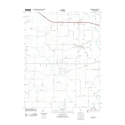
2012 Map of Woodlawn
USGS Topo · Published 2012About this map
Woodlawn sits at the center of this Jefferson County landscape, serving as a primary hub for the surrounding rural communities of Roaches and Rend Lake Camp. The area's industrial character is defined by the Woodlawn Oil Field, which sits south of the main town site along the winding path of Rayse Cr. This tributary, along with Novak Cr and Back Br, drains the undulating terrain toward the Big Muddy River on the eastern edge of the survey.
Find a feature on this map
117 named features on this map. Tap any name to fly to it.
Don’t see what you’re looking for? This feature index may not catch every label — zoom into the map to look around manually.
Map Details
Editions of this 2012 Woodlawn Map
This is the sole edition of this map. No revisions or reprints were ever made.
Other maps of this area

1926 · Duquoin
USGS Topo · 1:62,500

1933 · Mount Vernon
USGS Topo · 1:48,000

1939 · Ina
USGS Topo · 1:62,500

1940 · Mount Vernon
USGS Topo · 1:62,500

1943 · Ina
USGS Topo · 1:62,500

1943 · Ashley
USGS Topo · 1:62,500

1946 · Ashley
USGS Topo · 1:62,500

1958 · Belleville
USGS Topo · 1:250,000

1962 · Belleville
USGS Topo · 1:250,000
1965 · Mount Vernon
USGS Topo · 1:24,000