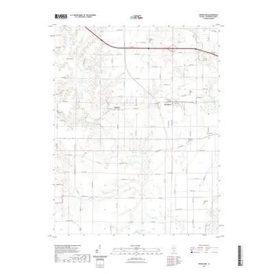
2021 Map of Woodlawn
USGS Topo · Published 2021About this map
Woodlawn and the smaller settlement of Roaches anchor this portion of Jefferson County, where the southern Illinois landscape is defined by the winding course of Rayse Creek and the Big Muddy River. The area maintains a high density of small family and community burial grounds, reflecting the deep-rooted genealogical history of the township. Local landmarks such as The Pinnacle rise above the drainage basins of Novak Creek and Back Branch, while a grid of rural routes including E Bakerville Rd and E Partisan Rd connects the scattered farmsteads. The proximity of multiple cemeteries, including the Odd Fellows Cem, Reynolds Cem, and Slade Cem, suggests a long-standing pattern of settlement that has persisted alongside the modern highway infrastructure that now bisects the northern sections of the quadrangle.
Find a feature on this map
99 named features on this map. Tap any name to fly to it.
Don’t see what you’re looking for? This feature index may not catch every label — zoom into the map to look around manually.
Map Details
Editions of this 2021 Woodlawn Map
This is the sole edition of this map. No revisions or reprints were ever made.
Other maps of this area

1926 · Duquoin
USGS Topo · 1:62,500

1933 · Mount Vernon
USGS Topo · 1:48,000

1939 · Ina
USGS Topo · 1:62,500

1940 · Mount Vernon
USGS Topo · 1:62,500

1943 · Ina
USGS Topo · 1:62,500

1943 · Ashley
USGS Topo · 1:62,500

1946 · Ashley
USGS Topo · 1:62,500

1958 · Belleville
USGS Topo · 1:250,000

1962 · Belleville
USGS Topo · 1:250,000
1965 · Mount Vernon
USGS Topo · 1:24,000