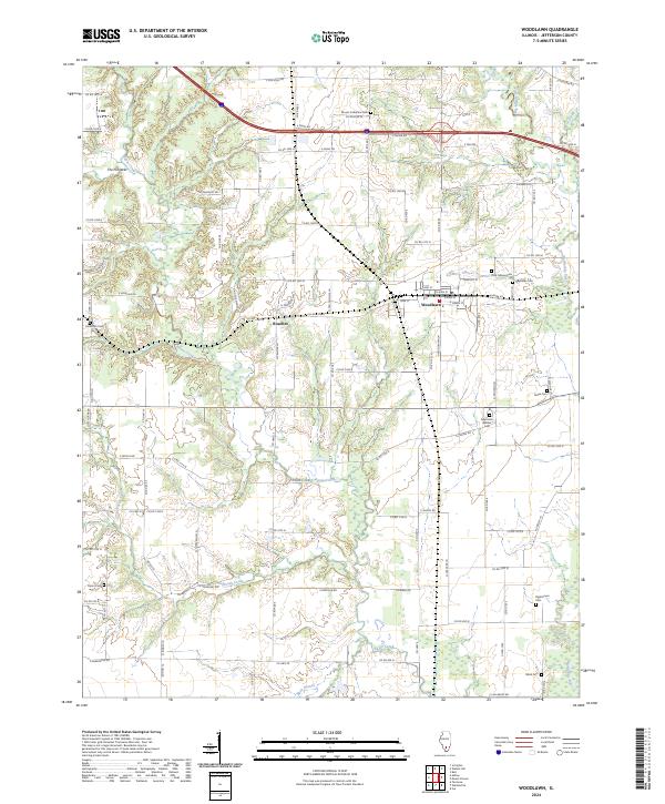
2024 Map of Woodlawn
USGS Topo · Published 2024About this map
Woodlawn and Roaches serve as the primary residential hubs in this western Jefferson County landscape, where the Jefferson County grid meets the meandering courses of Rayse Creek and the Big Muddy River. The map reveals a dense network of local cemeteries that speak to the area's genealogical depth, ranging from the Odd Fellows Cem and Reynolds Cem near the town center to the more secluded Taylor Cem and Black Cem further south.
Find a feature on this map
102 named features on this map. Tap any name to fly to it.
Don’t see what you’re looking for? This feature index may not catch every label — zoom into the map to look around manually.
Map Details
Editions of this 2024 Woodlawn Map
This is the sole edition of this map. No revisions or reprints were ever made.
Other maps of this area

1926 · Duquoin
USGS Topo · 1:62,500

1933 · Mount Vernon
USGS Topo · 1:48,000

1939 · Ina
USGS Topo · 1:62,500

1940 · Mount Vernon
USGS Topo · 1:62,500

1943 · Ina
USGS Topo · 1:62,500

1943 · Ashley
USGS Topo · 1:62,500

1946 · Ashley
USGS Topo · 1:62,500

1958 · Belleville
USGS Topo · 1:250,000

1962 · Belleville
USGS Topo · 1:250,000
1965 · Mount Vernon
USGS Topo · 1:24,000