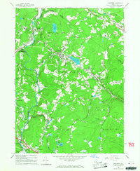
1966 Map of Woodridge
USGS Topo · Published 1968About this map
Woodridge and South Fallsburg serve as the primary hubs in this mid-1960s snapshot of Sullivan County, where the landscape is defined by the winding path of the Neversink River. The region showcases a mix of institutional presence and local recreation, notably the Woodbourne Correctional Institute in the north and a Ski Area and Drive-in Theater near Rock Hill in the south. Settlement patterns follow the valley floors and higher plateaus, with smaller hamlets like Mountain Dale and Glen Wild connected by a network of local routes such as the New Turnpike Road. The topography is marked by numerous water bodies, including Silver Lake at the center of Woodridge and Wolf Lake to the northwest, highlighting the area's transition into a seasonal destination. Scattered industry, like the Sand and Gravel Pit near Bridgeville, appears alongside community landmarks such as Hillside Cem and Central High Sch.
Find a feature on this map
52 named features on this map. Tap any name to fly to it.
Don’t see what you’re looking for? This feature index may not catch every label — zoom into the map to look around manually.
Map Details
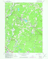
Editions of this 1966 Woodridge Map
2 editions found
Other maps of this area

1903 · Slide Mountain
USGS Topo · 1:62,500

1904 · Ellenville
USGS Topo · 1:62,500

1905 · Slide Mountain
USGS Topo · 1:62,500

1906 · Ellenville
USGS Topo · 1:62,500

1909 · Monticello
USGS Topo · 1:62,500

1910 · Neversink
USGS Topo · 1:62,500

1911 · Monticello
USGS Topo · 1:62,500

1942 · Neversink
USGS Topo · 1:62,500

1942 · Lackawack
USGS Topo · 1:24,000
1942 · Ellenville
USGS Topo · 1:24,000