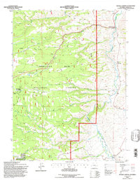
1992 Map of Woods Landing
USGS Topo · Published 1996About this map
Medicine Bow National Forest dominates this Wyoming landscape, where the Laramie River flows northward past a series of small, riverside settlements. This 1990s revision reveals the early 20th-century legacy of the area, including the small community of Woods Landing and the neighboring sites of New Jelm and Jelm. To the south, Boswell Ranch stands near the Blier and Boswell Ditch, indicating the importance of water management in this high-altitude terrain.
Find a feature on this map
27 named features on this map. Tap any name to fly to it.
Don’t see what you’re looking for? This feature index may not catch every label — zoom into the map to look around manually.
Map Details
Editions of this 1992 Woods Landing Map
This is the sole edition of this map. No revisions or reprints were ever made.
Other maps of this area

1895 · Laramie
USGS Topo · 1:125,000

1902 · Laramie
USGS Topo · 1:125,000

1905 · Laramie
USGS Topo · 1:125,000

1906 · Medicine Bow
USGS Topo · 1:125,000

1906 · Laramie
USGS Topo · 1:125,000

1908 · Laramie
USGS Topo · 1:125,000

1908 · Medicine Bow
USGS Topo · 1:125,000

1916 · Home
USGS Topo · 1:125,000

1920 · Home
USGS Topo · 1:125,000

1950 · Kings Canyon
USGS Topo · 1:24,000