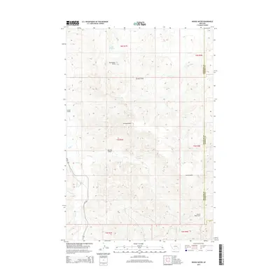
2014 Map of Woods Water
USGS Topo · Published 2014About this map
Rattlesnake Butte overlooks a landscape defined by an intricate network of drainage systems along the border of Treasure and Rosebud Counties. This 2014 survey captures a rural Montana terrain where water management is central to the land's utility, anchored by Haines Reservoir in the north and the spring-fed Woods Water to the south. The area is dissected by numerous named coulees, including the evocative Whiskey Coulee, Deveny Coulee, and Cache Coulee, which channel seasonal runoff toward larger systems like Sarpy Cr.
Find a feature on this map
22 named features on this map. Tap any name to fly to it.
Don’t see what you’re looking for? This feature index may not catch every label — zoom into the map to look around manually.
Map Details
Editions of this 2014 Woods Water Map
This is the sole edition of this map. No revisions or reprints were ever made.
Other maps of this area

1954 · Forsyth
USGS Topo · 1:250,000

1957 · Forsyth
USGS Topo · 1:250,000

1958 · Forsyth
USGS Topo · 1:250,000

1960 · Hysham
USGS Topo · 1:24,000

1960 · Sanders
USGS Topo · 1:24,000

1968 · Finch
USGS Topo · 1:24,000

1971 · Griffin Coulee SW
USGS Topo · 1:24,000
1971 · Griffin Coulee NW
USGS Topo · 1:24,000
1972 · Minnehaha Creek North
USGS Topo · 1:24,000
1972 · South Bear Creek
USGS Topo · 1:24,000