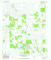
1966 Map of Woodson
USGS Topo · Published 1982About this map
Woodson serves as the primary hub in this West Texas landscape, situated at the intersection of Highway 183 and Highway 209. The town center includes essential community features such as an Athletic Field, Storage Bins, and a Sewage Disposal facility. Local industry is clearly defined by the expansive Oil Field operations and numerous Oil Well sites scattered throughout the terrain, alongside a notable Gravel Pit to the northeast.
Find a feature on this map
18 named features on this map. Tap any name to fly to it.
Don’t see what you’re looking for? This feature index may not catch every label — zoom into the map to look around manually.
Map Details
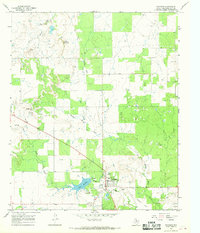
Editions of this 1966 Woodson Map
2 editions found
Other maps of this area

1890 · Breckenridge
USGS Topo · 1:125,000

1892 · Albany
USGS Topo · 1:125,000

1893 · Albany
USGS Topo · 1:125,000

1954 · Abilene
USGS Topo · 1:250,000

1954 · Wichita Falls
USGS Topo · 1:250,000

1958 · Wichita Falls
USGS Topo · 1:250,000

1958 · Abilene
USGS Topo · 1:250,000

1965 · Lusk
USGS Topo · 1:24,000

1965 · Fort Griffin
USGS Topo · 1:24,000

1965 · Throckmorton NE
USGS Topo · 1:24,000