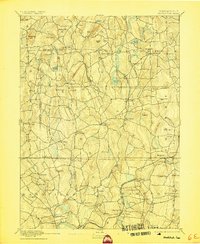
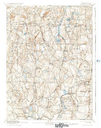
1892 Map of Woodstock
USGS Topo · Published 1905About this map
The New York and New England Railroad cuts across the southern portion of this landscape, connecting rural communities like Hampton Station and Chaplin Station during a period of industrial transition in northeastern Connecticut. The terrain is characterized by a dense network of brooks and rivers, including the Natchaug River and Mount Hope River, which supported numerous small mill settlements such as Kenyonville, Chaffeeville, and Atwoodville. These villages, often situated at river bends or junctions, represent the height of the area's local manufacturing and agricultural economy.
Find a feature on this map
95 named features on this map. Tap any name to fly to it.
Don’t see what you’re looking for? This feature index may not catch every label — zoom into the map to look around manually.
Map Details
Editions of this 1892 Woodstock Map
6 editions found
Other maps of this area

1887 · Brookfield
USGS Topo · 1:62,500

1887 · Palmer
USGS Topo · 1:62,500

1889 · Webster
USGS Topo · 1:62,500

1889 · Putnam
USGS Topo · 1:62,500

1889 · Palmer
USGS Topo · 1:62,500

1889 · Moosup
USGS Topo · 1:62,500

1890 · Brookfield
USGS Topo · 1:62,500

1892 · Woodstock
USGS Topo · 1:62,500

1892 · Webster
USGS Topo · 1:62,500

1892 · Tolland
USGS Topo · 1:62,500