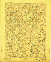
1892 Map of Woodstock
USGS Topo · Published 1911About this map
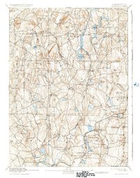
Mansfield Center and the surrounding hill country of eastern Connecticut appear here during a period of transition between an agrarian past and an industrializing future. The landscape is defined by its drainage basins, with the Mount Hope River, Natchaug River, and Fenton River carving through a series of named elevations such as Lead Mine Hill and Wormwood Hill. These watercourses powered the small-scale milling operations that supported decentralized settlements like Gurleyville, Kenyonville, and Phoenixville.
Find a feature on this map
95 named features on this map. Tap any name to fly to it.
Don’t see what you’re looking for? This feature index may not catch every label — zoom into the map to look around manually.
Map Details
Editions of this 1892 Woodstock Map
6 editions found
Other maps of this area

1887 · Brookfield
USGS Topo · 1:62,500

1887 · Palmer
USGS Topo · 1:62,500

1889 · Webster
USGS Topo · 1:62,500

1889 · Putnam
USGS Topo · 1:62,500

1889 · Palmer
USGS Topo · 1:62,500

1889 · Moosup
USGS Topo · 1:62,500

1890 · Brookfield
USGS Topo · 1:62,500

1892 · Woodstock
USGS Topo · 1:62,500

1892 · Webster
USGS Topo · 1:62,500

1892 · Tolland
USGS Topo · 1:62,500