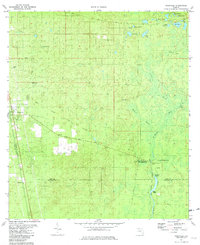
1981 Map of Woodville
USGS Topo · Published 1982About this map
Natural Bridge Battlefield State Historic Site anchors the southern portion of this landscape, marking where the St Marks River disappears underground into the Natural Bridge Sink. This hydrological phenomenon is surrounded by a dense network of karst features, including Rhodes Springs and St Marks Spring. The map documents a rural Florida transition, where the settlement of Woodville and the smaller community of Vereen are connected by the Seaboard Coast Line railroad and historic thoroughfares like the Old Plank Road.
Find a feature on this map
32 named features on this map. Tap any name to fly to it.
Don’t see what you’re looking for? This feature index may not catch every label — zoom into the map to look around manually.
Map Details
Editions of this 1981 Woodville Map
2 editions found
Other maps of this area

1940 · Tallahassee
USGS Topo · 1:62,500

1940 · Arran
USGS Topo · 1:62,500

1942 · Tallahassee
USGS Topo · 1:62,500

1943 · Arran
USGS Topo · 1:62,500

1943 · Tallahassee
USGS Topo · 1:62,500

1954 · Lloyd
USGS Topo · 1:24,000

1954 · Lafayette
USGS Topo · 1:24,000

1954 · Cody
USGS Topo · 1:24,000

1954 · Woodville
USGS Topo · 1:24,000

1954 · St. Marks NE
USGS Topo · 1:24,000