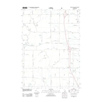
2012 Map of Woodville NE
USGS Topo · Published 2012About this map
The rolling wetlands and agricultural lands of Newaygo and Mecosta counties are meticulously detailed in this 2012 survey. The landscape is defined by its water system, where several creeks such as Mitchell Cr, Cold Spring Cr, and Betts Cr drain into numerous natural basins like Hungerford Lake and Mud Lake. This area north of Big Rapids is bisected by major transportation corridors and local section roads including Newcosta Ave and Cottonwood Ave. Local history is anchored by several burial grounds, including Van Gilder Cem, Mount Camp Cem, and Hungerford Cem, which provide essential points of reference for genealogists. To the east, the map captures the transition to more developed recreational and transit land uses, featuring the Roben-Hood Airport and the Katke Golf Course near the regional rest area.
Find a feature on this map
58 named features on this map. Tap any name to fly to it.
Don’t see what you’re looking for? This feature index may not catch every label — zoom into the map to look around manually.
Map Details
Editions of this 2012 Woodville NE Map
This is the sole edition of this map. No revisions or reprints were ever made.
Other maps of this area

1954 · Midland
USGS Topo · 1:250,000

1958 · Midland
USGS Topo · 1:250,000

1958 · Woodville
USGS Topo · 1:62,500

1958 · Big Rapids
USGS Topo · 1:62,500

1959 · Midland
USGS Topo · 1:250,000

1959 · Evart
USGS Topo · 1:62,500

1959 · Reed City
USGS Topo · 1:62,500

1966 · Midland
USGS Topo · 1:250,000

1976 · Evart SW
USGS Topo · 1:24,000

1976 · Big Rapids SW
USGS Topo · 1:24,000