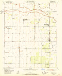
1951 Map of Woodville
USGS Topo · Published 1951About this map
The Tule River's tripartite drainage system—divided into its North Branch, Middle Branch, and South Branch—dominates this 1951 agricultural landscape in Tulare County. The map captures a moment of intensive irrigation engineering, where an intricate network of ditches like the Alta Robles Ditch and Poplar Ditch crisscross the valley floor to support the region's orchards and fields. Small rural hubs such as Woodville and Poplar serve as the primary social centers, while the Woodville Farm Labor Supply Center and the sprawling Schenley Ranch highlight the industrial scale of local agribusiness.
Find a feature on this map
29 named features on this map. Tap any name to fly to it.
Don’t see what you’re looking for? This feature index may not catch every label — zoom into the map to look around manually.
Map Details
Editions of this 1951 Woodville Map
2 editions found
Other maps of this area

1925 · Tulare
USGS Topo · 1:31,680

1925 · Tipton
USGS Topo · 1:31,680

1927 · Cairns Corner
USGS Topo · 1:31,680

1927 · Tulare
USGS Topo · 1:31,680

1928 · Tipton
USGS Topo · 1:31,680

1928 · Woodville
USGS Topo · 1:31,680

1928 · Lindsay
USGS Topo · 1:31,680

1929 · Sausalito School
USGS Topo · 1:31,680

1929 · Porterville
USGS Topo · 1:31,680

1929 · Pixley
USGS Topo · 1:31,680