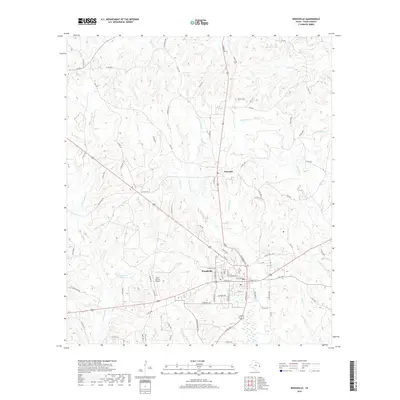
2019 Map of Woodville
USGS Topo · Published 2019About this map
Woodville serves as the central hub of this East Texas landscape, where the convergence of major regional routes meets a complex network of creeks and branches. This 2019 survey captures the community just north of the Tyler County Airport, showing a town structured around traditional street grids and newer developments like Barkley Ter. To the north lies Doucette, a smaller settlement positioned along the highway and near the headwaters of Doucette Br.
Find a feature on this map
88 named features on this map. Tap any name to fly to it.
Don’t see what you’re looking for? This feature index may not catch every label — zoom into the map to look around manually.
Map Details
Editions of this 2019 Woodville Map
This is the sole edition of this map. No revisions or reprints were ever made.
Other maps of this area

1954 · Beaumont
USGS Topo · 1:250,000

1955 · Woodville
USGS Topo · 1:62,500

1955 · Camden
USGS Topo · 1:62,500

1957 · Beaumont
USGS Topo · 1:250,000

1958 · Segno
USGS Topo · 1:62,500

1958 · Warren
USGS Topo · 1:62,500
1984 · Chester
USGS Topo · 1:24,000

1984 · Beaumont
USGS Topo · 1:250,000

1984 · Jacks Creek North
USGS Topo · 1:24,000
1984 · Woodville
USGS Topo · 1:24,000