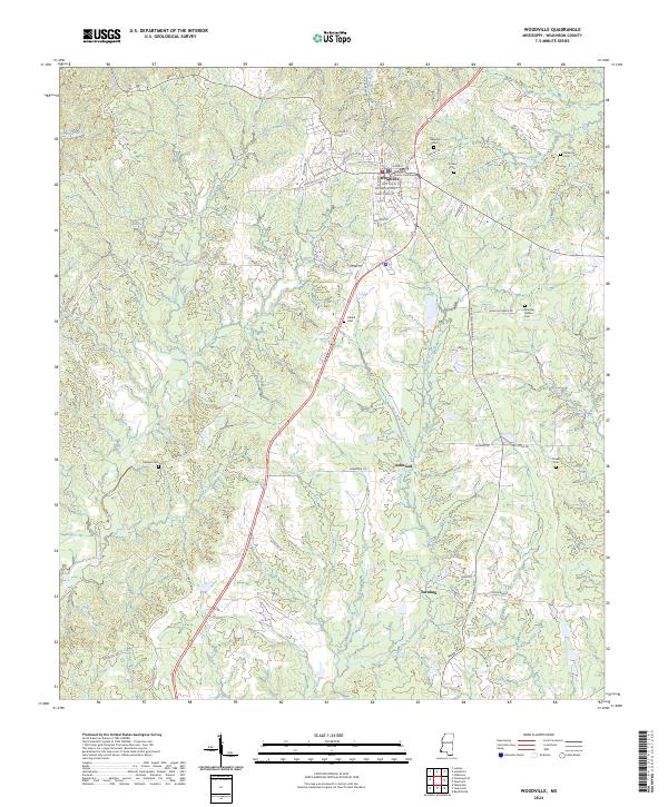
2024 Map of Woodville
USGS Topo · Published 2024About this map
Woodville, the historic seat of Wilkinson County, serves as the primary hub of this Mississippi landscape, centered on the Wilkinson County Courthouse. The town's grid is detailed with street-level precision, including local thoroughfares like Stop and Go St W and Gaylord St. Beyond the central settlement, the terrain is defined by the drainage basins of the West Fork Thompson Creek and Bayou Sara, which carve through the loess hills of the region.
Find a feature on this map
76 named features on this map. Tap any name to fly to it.
Don’t see what you’re looking for? This feature index may not catch every label — zoom into the map to look around manually.
Map Details
Editions of this 2024 Woodville Map
This is the sole edition of this map. No revisions or reprints were ever made.
Other maps of this area

1906 · Bayou Sara
USGS Topo · 1:125,000

1936 · Woodville
USGS Topo · 1:62,500

1939 · St. Francisville
USGS Topo · 1:62,500

1941 · Lost Creek
USGS Topo · 1:31,680

1945 · Lost Creek
USGS Topo · 1:31,680

1953 · Natchez
USGS Topo · 1:250,000

1954 · Baton Rouge
USGS Topo · 1:250,000

1956 · Natchez
USGS Topo · 1:250,000

1956 · Baton Rouge
USGS Topo · 1:250,000
1958 · Clinton
USGS Topo · 1:62,500