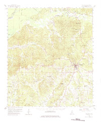
1958 Map of Woodville
USGS Topo · Published 1963About this map
Woodville serves as the hub of this Mississippi landscape, where the Illinois Central railroad terminates in a network of historic churches and small family settlements. The terrain is defined by the Homochitto River and its complex system of bayous, including Alligator Bayou and Dixons Bayou. For genealogists, the map is remarkably dense with rural institutions, from the Evening Star Ch in the north to the Pickneyville Sch in the southwest.
Find a feature on this map
108 named features on this map. Tap any name to fly to it.
Don’t see what you’re looking for? This feature index may not catch every label — zoom into the map to look around manually.
Map Details
Editions of this 1958 Woodville Map
4 editions found

Other maps of this area

1906 · Bayou Sara
USGS Topo · 1:125,000

1936 · Woodville
USGS Topo · 1:62,500

1939 · St. Francisville
USGS Topo · 1:62,500

1939 · Kingston
USGS Topo · 1:62,500

1939 · Artonish
USGS Topo · 1:62,500

1939 · Deer Park
USGS Topo · 1:62,500

1941 · Lost Creek
USGS Topo · 1:31,680

1941 · Batchelor
USGS Topo · 1:62,500

1945 · Lost Creek
USGS Topo · 1:31,680

1953 · Natchez
USGS Topo · 1:250,000