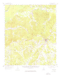
1958 Map of Woodville
USGS Topo · Published 1976About this map
Woodville serves as the central hub for this corner of Wilkinson County, where the Illinois Central railroad terminates after passing through the settlement of Ashwood. The landscape is defined by the winding course of the Buffalo River and the Homochitto River, which mark the northern reaches of the area. This late-1950s survey documents a remarkably dense network of rural community institutions, including dozens of country churches and schools like Magnolia Sch and St Matthews Ch that likely anchored family life for generations. In the south, the village of Pinckneyville sits near Arcole Cem and the Desert Creek drainage, while the Crosby Lookout Tower stands as a sentinel over the timberlands to the northeast. The presence of numerous named gravel pits and the transition from the river lowlands to the dissected uplands reflect a local economy tied to the land's natural resources and transport lines.
Find a feature on this map
98 named features on this map. Tap any name to fly to it.
Don’t see what you’re looking for? This feature index may not catch every label — zoom into the map to look around manually.
Map Details
Editions of this 1958 Woodville Map
4 editions found

Other maps of this area

1906 · Bayou Sara
USGS Topo · 1:125,000

1936 · Woodville
USGS Topo · 1:62,500

1939 · St. Francisville
USGS Topo · 1:62,500

1939 · Kingston
USGS Topo · 1:62,500

1939 · Artonish
USGS Topo · 1:62,500

1939 · Deer Park
USGS Topo · 1:62,500

1941 · Lost Creek
USGS Topo · 1:31,680

1941 · Batchelor
USGS Topo · 1:62,500

1945 · Lost Creek
USGS Topo · 1:31,680

1953 · Natchez
USGS Topo · 1:250,000