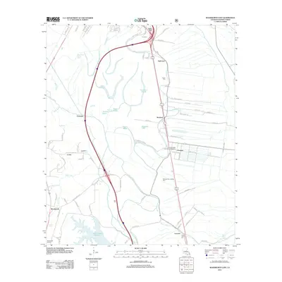
2012 Map of Woodworth East
USGS Topo · Published 2012About this map
Louisiana State University Alexandria anchors the eastern side of this central Louisiana landscape, where the flat alluvial plains of the Red River valley meet the upland drainage systems of Rapides Parish. The area is defined by an intricate network of waterways, including Bayou Robert, Bayou Boeuf, and Bayou Lamourie, which reflect the region's historic agricultural reliance on these natural irrigation and drainage channels. The map reveals a transition from the structured academic grounds of the university and neighboring settlements like Chambers and Moreland to the hydrologically complex wetlands of the south, marked by Indian Creek Reservoir and numerous sloughs like Harris Slough.
Find a feature on this map
85 named features on this map. Tap any name to fly to it.
Don’t see what you’re looking for? This feature index may not catch every label — zoom into the map to look around manually.
Map Details
Editions of this 2012 Woodworth East Map
This is the sole edition of this map. No revisions or reprints were ever made.
Other maps of this area

1935 · Lecompte
USGS Topo · 1:62,500

1941 · Alexandria
USGS Topo · 1:62,500

1941 · Boyce
USGS Topo · 1:62,500

1945 · Boyce SE
USGS Topo · 1:31,680

1949 · Boyce SE
USGS Topo · 1:31,680

1953 · Alexandria
USGS Topo · 1:250,000

1955 · Alexandria
USGS Topo · 1:250,000

1956 · Forest Hill
USGS Topo · 1:62,500

1956 · Boyce
USGS Topo · 1:62,500

1957 · Alexandria
USGS Topo · 1:62,500