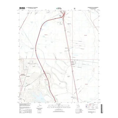
2015 Map of Woodworth East
USGS Topo · Published 2015About this map
Bayou Robert and Bayou Boeuf meander through this Rapides Parish landscape, defining the agricultural and residential patterns south of Alexandria. The map illustrates a transition from the structured campus of Louisiana State Univ at Alexandria and the growing residential pockets of Willow Glen, Inglewood, and Moreland to the managed timberlands of the Kisatchie National Forest. Local history is preserved in small family and community burial grounds, including Figgins Cem and Wise Cem, which sit alongside the legacy of former plantations indicated by Plantation Slough. Transportation infrastructure is a central theme, with the high-speed corridors of Highway 71 and Interstate 49 cutting through older settlements like Chambers and Lamourie, while aviation remains active at Woodworth Airport and the Summerville Airstrip.
Find a feature on this map
92 named features on this map. Tap any name to fly to it.
Don’t see what you’re looking for? This feature index may not catch every label — zoom into the map to look around manually.
Map Details
Editions of this 2015 Woodworth East Map
This is the sole edition of this map. No revisions or reprints were ever made.
Other maps of this area

1935 · Lecompte
USGS Topo · 1:62,500

1941 · Alexandria
USGS Topo · 1:62,500

1941 · Boyce
USGS Topo · 1:62,500

1945 · Boyce SE
USGS Topo · 1:31,680

1949 · Boyce SE
USGS Topo · 1:31,680

1953 · Alexandria
USGS Topo · 1:250,000

1955 · Alexandria
USGS Topo · 1:250,000

1956 · Forest Hill
USGS Topo · 1:62,500

1956 · Boyce
USGS Topo · 1:62,500

1957 · Alexandria
USGS Topo · 1:62,500