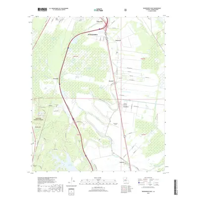
2018 Map of Woodworth East
USGS Topo · Published 2018About this map
The alluvial plains south of Alexandria are defined by a complex network of waterways, including Bayou Robert, Bayou Boeuf, and Bayou Lamourie. This 2018 survey captures a landscape of transition, where the urban outskirts meet agricultural fields and the wooded eastern edge of the Kisatchie National Forest. Educational and aviation hubs are prominent, with the Louisiana State Univ Alexandria campus situated near Chambers, alongside several local flight facilities like Grass Roots Airport and Woodworth Airport. Genealogy researchers can find several burial sites preserved amidst the development, such as Wise Cem, Saint John Cem, and Figgins Cem. The map illustrates the region's hydrography in detail, showing how modern irrigation and drainage, like the Chatlin Lake Canal, overlay the ancient wandering paths of Harris Slough and Plantation Slough.
Find a feature on this map
84 named features on this map. Tap any name to fly to it.
Don’t see what you’re looking for? This feature index may not catch every label — zoom into the map to look around manually.
Map Details
Editions of this 2018 Woodworth East Map
This is the sole edition of this map. No revisions or reprints were ever made.
Other maps of this area

1935 · Lecompte
USGS Topo · 1:62,500

1941 · Alexandria
USGS Topo · 1:62,500

1941 · Boyce
USGS Topo · 1:62,500

1945 · Boyce SE
USGS Topo · 1:31,680

1949 · Boyce SE
USGS Topo · 1:31,680

1953 · Alexandria
USGS Topo · 1:250,000

1955 · Alexandria
USGS Topo · 1:250,000

1956 · Forest Hill
USGS Topo · 1:62,500

1956 · Boyce
USGS Topo · 1:62,500

1957 · Alexandria
USGS Topo · 1:62,500