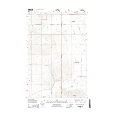
2014 Map of Woodworth
USGS Topo · Published 2014About this map
Lolo National Forest dominates the northern reaches of this Montana landscape, where the terrain transitions from timbered slopes into the broad open expanse of Blanchard Flats. The settlement of Woodworth sits near the county line between Missoula and Powell counties, serving as a focal point for a network of forest and ranch roads. Water is a defining element of the southern geography, where the Blackfoot River flows through the valley, joined by tributaries like Chamberlain Cr and Cottonwood Cr. The map reveals a land utilized for both timber and aviation, featuring both the Black Canyon Ranch Airport and the Buffalo Trail Ranch Strip Airport. In the southwest corner, the small community of Clearwater marks a junction point near the river, while high-altitude lakes such as Tote Road Lake and Cott Lake dot the more rugged sections of the forest.
Find a feature on this map
33 named features on this map. Tap any name to fly to it.
Don’t see what you’re looking for? This feature index may not catch every label — zoom into the map to look around manually.
Map Details
Editions of this 2014 Woodworth Map
This is the sole edition of this map. No revisions or reprints were ever made.
Other maps of this area

1902 · Ovando
USGS Topo · 1:125,000

1905 · Ovando
USGS Topo · 1:125,000

1919 · Drummond
USGS Topo · 1:125,000

1921 · Drummond
USGS Topo · 1:125,000

1947 · Butte
USGS Topo · 1:250,000

1955 · Choteau
USGS Topo · 1:250,000

1957 · Choteau
USGS Topo · 1:250,000

1958 · Butte
USGS Topo · 1:250,000

1958 · Choteau
USGS Topo · 1:250,000

1960 · Butte
USGS Topo · 1:250,000