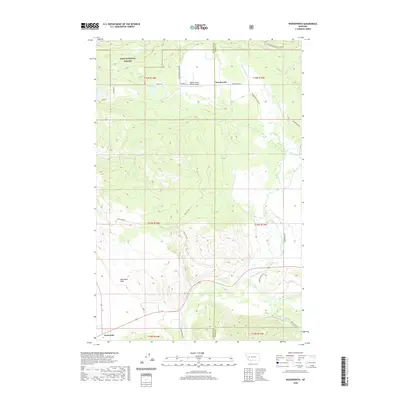
2020 Map of Woodworth
USGS Topo · Published 2020About this map
The Blackfoot River carves through the southern landscape of this terrain, marking a significant corridor between the Lolo National Forest and the lower flats. The settlement of Woodworth sits at a junction of backcountry routes like Woodworth Rd and Skilly Dr, serving as a central point for the surrounding ranching and timber geography. To the west, the small community of Clearwater anchors the southwestern corner, situated near the broad expanse of Blanchard Flats. This area is defined by its intricate drainage network, with Cottonwood Cr and Black Canyon Cr feeding toward the river valley. Notable aviation history is represented by the Black Canyon Ranch Airport, located just west of Woodworth. The map details a complex web of forest and ranch roads, including Westgate Rd and Southgate Rd, which provide access to the timbered slopes and high meadows.
Find a feature on this map
31 named features on this map. Tap any name to fly to it.
Don’t see what you’re looking for? This feature index may not catch every label — zoom into the map to look around manually.
Map Details
Editions of this 2020 Woodworth Map
This is the sole edition of this map. No revisions or reprints were ever made.
Other maps of this area

1902 · Ovando
USGS Topo · 1:125,000

1905 · Ovando
USGS Topo · 1:125,000

1919 · Drummond
USGS Topo · 1:125,000

1921 · Drummond
USGS Topo · 1:125,000

1947 · Butte
USGS Topo · 1:250,000

1955 · Choteau
USGS Topo · 1:250,000

1957 · Choteau
USGS Topo · 1:250,000

1958 · Butte
USGS Topo · 1:250,000

1958 · Choteau
USGS Topo · 1:250,000

1960 · Butte
USGS Topo · 1:250,000