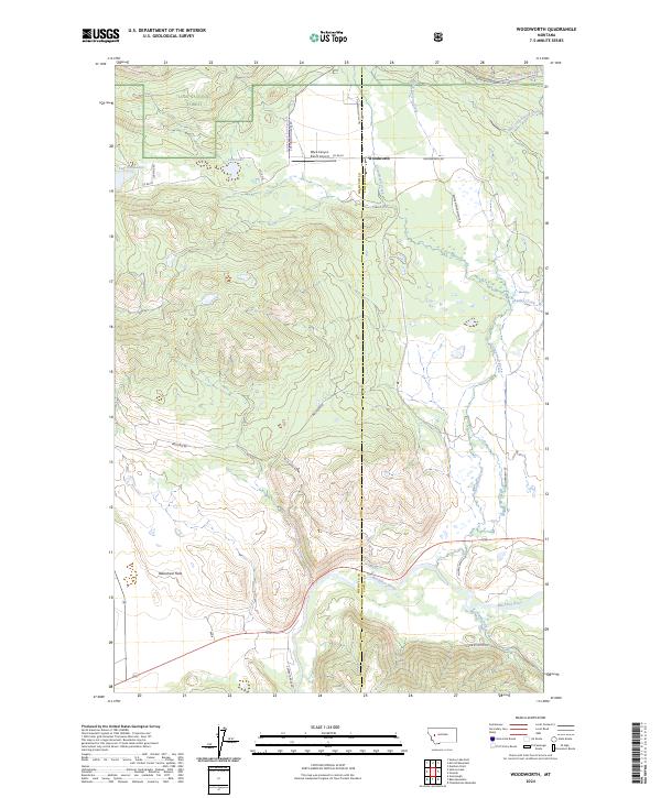
2024 Map of Woodworth
USGS Topo · Published 2024About this map
Woodworth and the northern reaches of the Blackfoot River define this Montana landscape, where the valley floor transitions into the protected timberlands of the Lolo National Forest. The map documents a complex network of resource management and rural infrastructure, from the Black Canyon Ranch Airport to the expansive Blackfoot Valley Conservation Area. The terrain is characterized by the broad Blanchard Flats and a series of watercourses including Cottonwood Creek and Chamberlain Creek that drain toward the Blackfoot. A legacy of land use is visible in the naming of access routes like Sperry Grade Rd, Logging Rd, and Range Management Rd, illustrating the intersection of ranching, forestry, and conservation efforts. Smaller landmarks such as Tote Road Lake and Cott Lake appear alongside various trails, including the Horseshoe Hills Trl, providing a detailed look at the backcountry connectivity of Powell County.
Find a feature on this map
33 named features on this map. Tap any name to fly to it.
Don’t see what you’re looking for? This feature index may not catch every label — zoom into the map to look around manually.
Map Details
Editions of this 2024 Woodworth Map
This is the sole edition of this map. No revisions or reprints were ever made.
Other maps of this area

1902 · Ovando
USGS Topo · 1:125,000

1905 · Ovando
USGS Topo · 1:125,000

1919 · Drummond
USGS Topo · 1:125,000

1921 · Drummond
USGS Topo · 1:125,000

1947 · Butte
USGS Topo · 1:250,000

1955 · Choteau
USGS Topo · 1:250,000

1957 · Choteau
USGS Topo · 1:250,000

1958 · Butte
USGS Topo · 1:250,000

1958 · Choteau
USGS Topo · 1:250,000

1960 · Butte
USGS Topo · 1:250,000