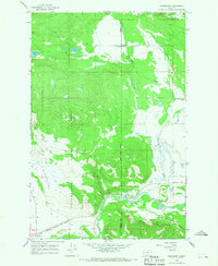
1965 Map of Woodworth
USGS Topo · Published 1968About this map
Woodworth and the timber-rich lands of the Clearwater State Forest define this mid-1960s landscape at the intersection of Missoula and Powell Counties. The terrain transitions from the high elevations of the Lolo National Forest down toward the Blanchard Flats in the southwest corner. The Chicago Milwaukee St Paul and Pacific railroad cuts through the southern reach of the map, following the broad valley near Clearwater. This survey captures the infrastructure of rural educational and utility development, noting the Park Sch and a nearby Substation. The hydrological network is well-defined, showing the course of the Blackfoot River as it receives drainage from Cottonwood Creek and Chamberlain Creek, while smaller water bodies like Tote Road Lake and Cott Lake dot the northern forested sections.
Find a feature on this map
18 named features on this map. Tap any name to fly to it.
Don’t see what you’re looking for? This feature index may not catch every label — zoom into the map to look around manually.
Map Details
Editions of this 1965 Woodworth Map
This is the sole edition of this map. No revisions or reprints were ever made.
Other maps of this area

1902 · Ovando
USGS Topo · 1:125,000

1905 · Ovando
USGS Topo · 1:125,000

1919 · Drummond
USGS Topo · 1:125,000

1921 · Drummond
USGS Topo · 1:125,000

1947 · Butte
USGS Topo · 1:250,000

1955 · Choteau
USGS Topo · 1:250,000

1957 · Choteau
USGS Topo · 1:250,000

1958 · Butte
USGS Topo · 1:250,000

1958 · Choteau
USGS Topo · 1:250,000

1960 · Butte
USGS Topo · 1:250,000