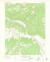
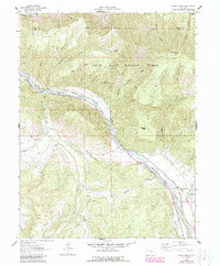
1961 Map of Woody Creek
USGS Topo · Published 1967About this map
The Roaring Fork River corridor defines this 1961 mountain landscape, where the Denver and Rio Grande Western railroad tracks parallel the water through the valley floor. Settled pockets at Snowmass and the namesake Woody Creek are connected by a sophisticated network of water management features, including the Walker Wonder Ditch, Salvation Ditch, and Denver Ditch. These irrigation channels reflect the area's agricultural and logistical efforts to divert alpine runoff from tributaries like Snowmass Creek and Brush Creek toward more arid ranching tracts.
Find a feature on this map
34 named features on this map. Tap any name to fly to it.
Don’t see what you’re looking for? This feature index may not catch every label — zoom into the map to look around manually.
Map Details
Editions of this 1961 Woody Creek Map
5 editions found
Other maps of this area

1893 · Aspen
USGS Topo · 1:62,500

1895 · Aspen
USGS Topo · 1:62,500

1909 · Mount Jackson
USGS Topo · 1:125,000

1911 · Mount Jackson
USGS Topo · 1:125,000

1957 · Leadville
USGS Topo · 1:250,000

1959 · Leadville
USGS Topo · 1:250,000

1960 · Leadville
USGS Topo · 1:250,000

1960 · Highland Peak
USGS Topo · 1:24,000

1960 · Capitol Peak
USGS Topo · 1:24,000

1960 · Aspen
USGS Topo · 1:24,000