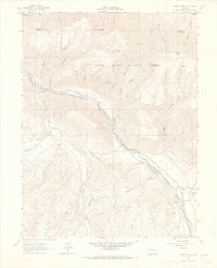
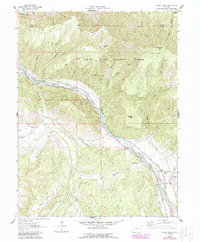
1961 Map of Woody Creek
USGS Topo · Published 1967About this map
The Roaring Fork River carves a central corridor through this mountain landscape in the early 1960s, serving as the primary geographic anchor for the settlements of Snowmass and Woody Creek. The transportation network is defined by the Denver and Rio Grande Western Railroad and several rugged Pack Trails that climb into the higher elevations of the White River National Forest. Significant irrigation engineering is evident through the extensive system of ditches, including the Salvation Ditch, Denver Ditch, and Snowmass Ditch, which redirect water from alpine tributaries to the valley floor. High-altitude landmarks like Sloane 10502 Peak and Watson Divide overlook a terrain marked by numerous named gulches such as Besancon Gulch and Arbaney Gulch, reflecting the local family names tied to the region's ranching and mining history.
Find a feature on this map
40 named features on this map. Tap any name to fly to it.
Don’t see what you’re looking for? This feature index may not catch every label — zoom into the map to look around manually.
Map Details
Editions of this 1961 Woody Creek Map
5 editions found
Other maps of this area

1893 · Aspen
USGS Topo · 1:62,500

1895 · Aspen
USGS Topo · 1:62,500

1909 · Mount Jackson
USGS Topo · 1:125,000

1911 · Mount Jackson
USGS Topo · 1:125,000

1957 · Leadville
USGS Topo · 1:250,000

1959 · Leadville
USGS Topo · 1:250,000

1960 · Leadville
USGS Topo · 1:250,000

1960 · Highland Peak
USGS Topo · 1:24,000

1960 · Capitol Peak
USGS Topo · 1:24,000

1960 · Aspen
USGS Topo · 1:24,000