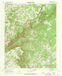
1968 Map of Woolwine
USGS Topo · Published 1971About this map
Sugarloaf Mountain and the high ridges of the Blue Ridge dominate this 1960s landscape along the border of Floyd and Patrick counties. The Blue Ridge Parkway winds through the northern section, passing through Tuggle Gap and leading toward the Rocky Knob Recreation Area. This era shows a transition between traditional mountain livelihoods and growing public recreation, as campgrounds and overlooks appear alongside older landmarks like Rakes Millpond.
Find a feature on this map
43 named features on this map. Tap any name to fly to it.
Don’t see what you’re looking for? This feature index may not catch every label — zoom into the map to look around manually.
Map Details
Editions of this 1968 Woolwine Map
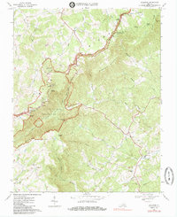
2 editions found
Other maps of this area

1926 · Critz
USGS Topo · 1:48,000

1928 · Stuart
USGS Topo · 1:48,000

1928 · Critz
USGS Topo · 1:62,500

1931 · Stuart
USGS Topo · 1:62,500

1953 · Winston-Salem
USGS Topo · 1:250,000

1955 · Winston-Salem
USGS Topo · 1:250,000

1957 · Endicott
USGS Topo · 1:62,500

1957 · Floyd
USGS Topo · 1:62,500

1962 · Winston-Salem
USGS Topo · 1:250,000

1967 · Patrick Springs
USGS Topo · 1:24,000