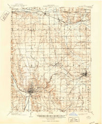
1903 Map of Wooster
USGS Topo · Published 1950About this map
Wooster and its surrounding townships in Wayne County reveal a landscape shaped by early 20th-century agriculture and social institutions. The city serves as a central hub, notably featuring the Wooster University and the State Experiment Station, illustrating the area's long-standing commitment to education and scientific farming. Beyond the city center, the map identifies various social landmarks of the era, including a Childrens Home, an Infirmary, and a Mennonite Home near the eastern border.
Find a feature on this map
52 named features on this map. Tap any name to fly to it.
Don’t see what you’re looking for? This feature index may not catch every label — zoom into the map to look around manually.
Map Details
Editions of this 1903 Wooster Map
2 editions found
Other maps of this area

1901 · Massillon
USGS Topo · 1:62,500

1901 · Wooster
USGS Topo · 1:62,500

1903 · Massillon
USGS Topo · 1:62,500

1903 · Wooster
USGS Topo · 1:62,500

1903 · Akron
USGS Topo · 1:62,500

1904 · Medina
USGS Topo · 1:62,500

1904 · Wellington
USGS Topo · 1:62,500

1905 · Akron
USGS Topo · 1:62,500

1906 · Medina
USGS Topo · 1:62,500

1906 · Wellington
USGS Topo · 1:62,500