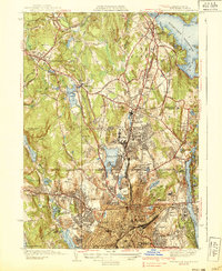
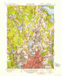
1939 Map of Worcester North
USGS Topo · Published 1939About this map
Worcester's northern reaches and the surrounding townships of Holden and West Boylston are captured here just before the Second World War. The landscape is defined by the massive footprint of the Wachusett Reservoir to the northeast and the industrial and academic density of the city to the south. This era shows a community heavily invested in public health and education, evidenced by the numerous specialized institutions like the Worcester Co Tuberculosis Hospital, Belmont Hospital, and the sprawling City Farm.
Find a feature on this map
83 named features on this map. Tap any name to fly to it.
Don’t see what you’re looking for? This feature index may not catch every label — zoom into the map to look around manually.
Map Details
Editions of this 1939 Worcester North Map
5 editions found
Other maps of this area

1885 · Worcester
USGS Topo · 1:62,500

1886 · Worcester
USGS Topo · 1:62,500

1886 · Blackstone
USGS Topo · 1:62,500

1887 · Marlboro
USGS Topo · 1:62,500

1889 · Marlboro
USGS Topo · 1:62,500

1889 · Blackstone
USGS Topo · 1:62,500

1889 · Webster
USGS Topo · 1:62,500

1892 · Webster
USGS Topo · 1:62,500

1892 · Worcester
USGS Topo · 1:62,500

1893 · Blackstone
USGS Topo · 1:62,500