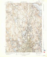
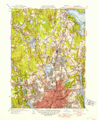
1939 Map of Worcester North
USGS Topo · Published 1939About this map
Worcester stands as a dense urban and industrial hub in the late 1930s, its growth anchored by the Boston and Maine Railroad and the Boston and Albany Railroad. The city is notable for its concentration of institutional landmarks, ranging from medical facilities like Worcester State Hospital and Belmont Hospital to academic centers including Assumption College and Clark University. The northern landscape transitions into a more hydraulic-focused environment, defined by the expansive Wachusett Reservoir and several water bodies such as Indian Lake and Chaffin Pond. This era reflects a highly developed transportation and utility network, where old settlements like Holden Center and Morningdale are integrated with modern infrastructure, including the aviation grounds at Logan Field and a series of municipal parks like Green Hill Park and Elm Park.
Find a feature on this map
84 named features on this map. Tap any name to fly to it.
Don’t see what you’re looking for? This feature index may not catch every label — zoom into the map to look around manually.
Map Details
Editions of this 1939 Worcester North Map
5 editions found
Other maps of this area

1885 · Worcester
USGS Topo · 1:62,500

1886 · Worcester
USGS Topo · 1:62,500

1886 · Blackstone
USGS Topo · 1:62,500

1887 · Marlboro
USGS Topo · 1:62,500

1889 · Marlboro
USGS Topo · 1:62,500

1889 · Blackstone
USGS Topo · 1:62,500

1889 · Webster
USGS Topo · 1:62,500

1892 · Webster
USGS Topo · 1:62,500

1892 · Worcester
USGS Topo · 1:62,500

1893 · Blackstone
USGS Topo · 1:62,500