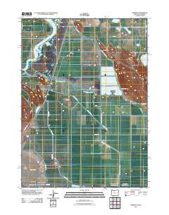
2011 Map of Worden
USGS Topo · Published 2011About this map
Klamath River meanders through this landscape at the onset of the 2010s, defining a region where water management and agriculture are deeply intertwined. The settlement of Worden sits alongside the highway corridor, while Midland is situated to the north near the Midland Safety Rest Area. The map reveals an extensive network of engineered waterways, including the Ady Canal, Center Canal, and the Klamath Strait Drain, which facilitate the irrigation of low-lying areas like Tulana Farms.
Find a feature on this map
30 named features on this map. Tap any name to fly to it.
Don’t see what you’re looking for? This feature index may not catch every label — zoom into the map to look around manually.
Map Details
Editions of this 2011 Worden Map
This is the sole edition of this map. No revisions or reprints were ever made.
Other maps of this area

1886 · Modoc Lava Bed
USGS Topo · 1:250,000

1889 · Klamath
USGS Topo · 1:250,000

1892 · Modoc Lava-Bed
USGS Topo · 1:250,000

1894 · Klamath
USGS Topo · 1:250,000

1950 · Mt. Dome
USGS Topo · 1:62,500

1950 · Dorris
USGS Topo · 1:62,500

1954 · Alturas
USGS Topo · 1:250,000

1955 · Klamath Falls
USGS Topo · 1:250,000

1957 · Merrill
USGS Topo · 1:62,500

1957 · Klamath Falls
USGS Topo · 1:62,500