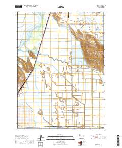
2020 Map of Worden
USGS Topo · Published 2020About this map
Klamath River meanders through the northwest corner of this region, feeding into the expansive wetlands of Furber Marsh and a sophisticated network of agricultural irrigation. The settlement of Worden sits at the base of the rising terrain, accompanied by the Worden Cem nearby. This 2020 landscape is defined by the stark contrast between the low-lying basins and the prominent Klamath Hills to the east, which include the notable summit of Captain Jack.
Find a feature on this map
37 named features on this map. Tap any name to fly to it.
Don’t see what you’re looking for? This feature index may not catch every label — zoom into the map to look around manually.
Map Details
Editions of this 2020 Worden Map
This is the sole edition of this map. No revisions or reprints were ever made.
Other maps of this area

1886 · Modoc Lava Bed
USGS Topo · 1:250,000

1889 · Klamath
USGS Topo · 1:250,000

1892 · Modoc Lava-Bed
USGS Topo · 1:250,000

1894 · Klamath
USGS Topo · 1:250,000

1950 · Mt. Dome
USGS Topo · 1:62,500

1950 · Dorris
USGS Topo · 1:62,500

1954 · Alturas
USGS Topo · 1:250,000

1955 · Klamath Falls
USGS Topo · 1:250,000

1957 · Merrill
USGS Topo · 1:62,500

1957 · Klamath Falls
USGS Topo · 1:62,500