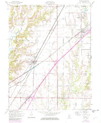
1954 Map of Worden
USGS Topo · Published 1982About this map
Worden, Livingston, and Hamel anchor this rural Madison County landscape, where the agricultural grid is deeply integrated with a heavy industrial and transportation framework. The map reveals the extensive rail infrastructure required for the region's extraction economy, featuring the Chicago and North Western and Conrail lines, as well as several Mine Dumps and Oil Wells scattered across the prairie. The presence of numerous family and community landmarks like Hoxey Cem and Suhre Sch illustrates a settled rural society built around the intersection of local roads and the regional rail network.
Find a feature on this map
38 named features on this map. Tap any name to fly to it.
Don’t see what you’re looking for? This feature index may not catch every label — zoom into the map to look around manually.
Map Details
Editions of this 1954 Worden Map
4 editions found

Other maps of this area

1912 · Gillespie
USGS Topo · 1:62,500

1915 · Gillespie
USGS Topo · 1:62,500

1915 · Mount Olive
USGS Topo · 1:62,500

1927 · Edwardsville
USGS Topo · 1:62,500

1932 · Edwardsville
USGS Topo · 1:62,500

1937 · New Douglas
USGS Topo · 1:48,000

1944 · New Douglas
USGS Topo · 1:62,500

1944 · Mount Olive
USGS Topo · 1:62,500

1950 · Edwardsville
USGS Topo · 1:24,000
1954 · Marine
USGS Topo · 1:24,000