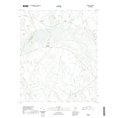
2020 Map of Workman
USGS Topo · Published 2020About this map
Martins Crossroads serves as a central point in this rural landscape, situated at the junction of several county roads in Williamsburg County. The area is defined by the winding course of the Black River and its extensive network of drainages, including Pudding Swamp and Clapp Swamp. These waterways create a mosaic of wetlands and small lakes like Duke Lake and Cypress Pond, which historically shaped the settlement patterns and agricultural layout of the region. The boundary between Clarendon Co and Williamsburg Co cuts through the western portion of the map, near the isolated Conyer Lake Island. Genealogists may find interest in the Mount Vernon Cem, located near the intersection of several local routes, and the small clusters of activity at Workman and Mouzon that represent the quiet rural community life of the early 21st century.
Find a feature on this map
67 named features on this map. Tap any name to fly to it.
Don’t see what you’re looking for? This feature index may not catch every label — zoom into the map to look around manually.
Map Details
Editions of this 2020 Workman Map
This is the sole edition of this map. No revisions or reprints were ever made.
Other maps of this area

1920 · Mayesville
USGS Topo · 1:48,000

1920 · Manning
USGS Topo · 1:48,000

1921 · Manning
USGS Topo · 1:62,500

1921 · Mayesville
USGS Topo · 1:62,500

1943 · Mayesville
USGS Topo · 1:62,500

1944 · Manning
USGS Topo · 1:62,500

1946 · Kingstree
USGS Topo · 1:62,500

1946 · Lake City
USGS Topo · 1:62,500

1949 · Georgetown
USGS Topo · 1:250,000

1954 · Augusta
USGS Topo · 1:250,000