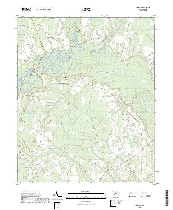
2024 Map of Workman
USGS Topo · Published 2024About this map
The Black River winds through a landscape of low-lying wetlands and scattered rural settlements along the border of Clarendon and Williamsburg counties. This coastal plain environment is defined by its intricate hydrography, including the broad Conyers Bay and several named swamp systems like Bennett Swamp and Bidding Swamp. Small community hubs such as Workman and Mouzon are connected by a network of local roads that thread between these water bodies and timbered lands.
Find a feature on this map
69 named features on this map. Tap any name to fly to it.
Don’t see what you’re looking for? This feature index may not catch every label — zoom into the map to look around manually.
Map Details
Editions of this 2024 Workman Map
This is the sole edition of this map. No revisions or reprints were ever made.
Other maps of this area

1920 · Mayesville
USGS Topo · 1:48,000

1920 · Manning
USGS Topo · 1:48,000

1921 · Manning
USGS Topo · 1:62,500

1921 · Mayesville
USGS Topo · 1:62,500

1943 · Mayesville
USGS Topo · 1:62,500

1944 · Manning
USGS Topo · 1:62,500

1946 · Kingstree
USGS Topo · 1:62,500

1946 · Lake City
USGS Topo · 1:62,500

1949 · Georgetown
USGS Topo · 1:250,000

1954 · Augusta
USGS Topo · 1:250,000