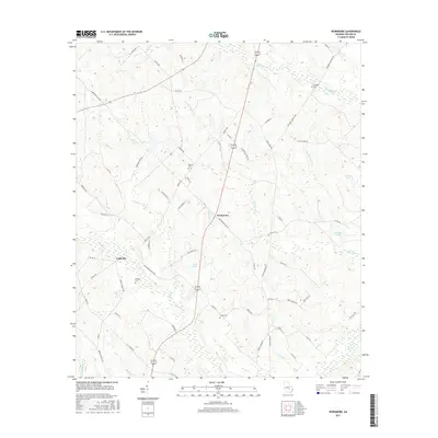
2017 Map of Workmore
USGS Topo · Published 2017About this map
Workmore and Cobbville anchor this section of Telfair County, representing the quiet rural character of south-central Georgia. The landscape is defined by an intricate network of waterways, including Turnpike Cr, Little Horse Cr, and Smokehouse Br, which weave between small family-owned ponds and lakes like Walkers Pond and Mceachin Lake. This survey is particularly valuable for genealogists and local historians, as it meticulously identifies several dispersed burial grounds that mark the heritage of the area's early settlers. Key sites include Turnpike Cem in the northeast, McLean Cem near the center, and both Graham Cem and Webb Cem further south. The road network, comprising named routes like Bethlehem Church Rd and Turnpike Cemetery Rd, suggests a community long organized around its local landmarks and parish boundaries.
Find a feature on this map
64 named features on this map. Tap any name to fly to it.
Don’t see what you’re looking for? This feature index may not catch every label — zoom into the map to look around manually.
Map Details
Editions of this 2017 Workmore Map
This is the sole edition of this map. No revisions or reprints were ever made.
Other maps of this area

1953 · Waycross
USGS Topo · 1:250,000

1957 · Macon
USGS Topo · 1:250,000

1958 · Macon
USGS Topo · 1:250,000

1958 · Waycross
USGS Topo · 1:250,000

1964 · Macon
USGS Topo · 1:250,000

1970 · Scotland
USGS Topo · 1:24,000

1971 · Jacksonville NE
USGS Topo · 1:24,000

1971 · Snipesville
USGS Topo · 1:24,000

1972 · Cooks Still
USGS Topo · 1:24,000

1972 · Jacksonville
USGS Topo · 1:24,000