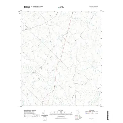
2020 Map of Workmore
USGS Topo · Published 2020About this map
Workmore and Cobbville serve as the primary nodes of settlement in this rural expanse of Telfair County. The landscape is defined by a dense network of creek drainages, most notably Turnpike Cr and the various branches of Little Horse Cr. These waterways dictate the positioning of local roads like Workmore Milan Rd and Temperance Rd. For those researching local family history, several burial sites are documented across the terrain, including Graham Cem near the western boundary and McLean Cem to the north. The geography is further punctuated by localized water bodies such as Jones Lake and Walkers Pond, illustrating the hydraulic character of the Georgia coastal plain. Smaller tributaries like Boggy Br and Smokehouse Br feed into the larger creek systems, while roads such as Bethelhem Church Rd suggest historical community centers centered on local congregations.
Find a feature on this map
64 named features on this map. Tap any name to fly to it.
Don’t see what you’re looking for? This feature index may not catch every label — zoom into the map to look around manually.
Map Details
Editions of this 2020 Workmore Map
This is the sole edition of this map. No revisions or reprints were ever made.
Other maps of this area

1953 · Waycross
USGS Topo · 1:250,000

1957 · Macon
USGS Topo · 1:250,000

1958 · Macon
USGS Topo · 1:250,000

1958 · Waycross
USGS Topo · 1:250,000

1964 · Macon
USGS Topo · 1:250,000

1970 · Scotland
USGS Topo · 1:24,000

1971 · Jacksonville NE
USGS Topo · 1:24,000

1971 · Snipesville
USGS Topo · 1:24,000

1972 · Cooks Still
USGS Topo · 1:24,000

1972 · Jacksonville
USGS Topo · 1:24,000