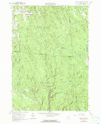
1960 Map of Worth Center
USGS Topo · Published 1990About this map
Worth Center sits at the northern edge of a landscape defined by significant conservation and water management efforts. In the late 1950s, this region across the Jefferson and Oswego County line was heavily shaped by the State Reforestation Area and a large Game Management Area, reflecting a transition from early agricultural attempts to state-led land reclamation. The topography is intricately carved by the Mad River and numerous tributaries such as Abijah Creek, Big Brook, and Grindstone Creek, which drain the plateau-like terrain. Small, remote settlements like Littlejohn and Osceola appear as quiet outposts connected by thoroughfares like Littlejohn Drive and Old State Rd. A Lookout Tower near the Jefferson and Lewis County border provides a focal point for fire observation across the densely forested tracts and features like Alder Bed Pond.
Find a feature on this map
34 named features on this map. Tap any name to fly to it.
Don’t see what you’re looking for? This feature index may not catch every label — zoom into the map to look around manually.
Map Details
Editions of this 1960 Worth Center Map
4 editions found
Other maps of this area

1895 · Watertown
USGS Topo · 1:62,500

1898 · Watertown
USGS Topo · 1:62,500

1902 · Carthage
USGS Topo · 1:62,500

1903 · Orwell
USGS Topo · 1:62,500

1904 · Carthage
USGS Topo · 1:62,500

1905 · Orwell
USGS Topo · 1:62,500

1906 · Highmarket
USGS Topo · 1:62,500

1908 · Watertown
USGS Topo · 1:62,500

1909 · Watertown
USGS Topo · 1:62,500

1942 · Redfield
USGS Topo · 1:24,000