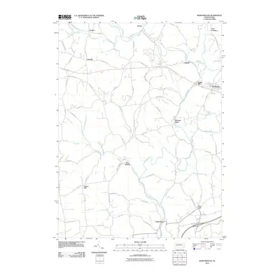
2010 Map of Worthington
USGS Topo · Published 2010About this map
Buffalo Creek winds through this section of Armstrong County, anchoring a landscape defined by historic milling sites and small crossroads settlements. The corridor between Worthington and Craigsville reveals a concentration of early industrial activity, notably at Buffalo Mills and downstream at Dennys Mills. These locations emphasize the importance of water power and rail access to the development of the local economy.
Find a feature on this map
89 named features on this map. Tap any name to fly to it.
Don’t see what you’re looking for? This feature index may not catch every label — zoom into the map to look around manually.
Map Details
Editions of this 2010 Worthington Map
This is the sole edition of this map. No revisions or reprints were ever made.
Other maps of this area

1900 · Kittanning
USGS Topo · 1:62,500

1902 · Kittanning
USGS Topo · 1:62,500

1907 · Freeport
USGS Topo · 1:62,500

1908 · New Kensington
USGS Topo · 1:62,500

1909 · Freeport
USGS Topo · 1:62,500

1909 · Butler
USGS Topo · 1:62,500

1910 · New Kensington
USGS Topo · 1:62,500

1911 · Butler
USGS Topo · 1:62,500

1953 · Pittsburgh
USGS Topo · 1:250,000
1953 · Curtisville
USGS Topo · 1:24,000