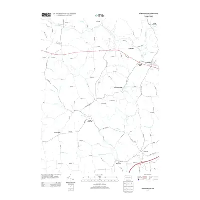
2013 Map of Worthington
USGS Topo · Published 2013About this map
Buffalo Cr winds through this Armstrong County landscape, defining a terrain of narrow valleys and established rural communities. The map depicts the borough of Worthington and the nearby settlement of Buffalo Mills along the Us-422 corridor, showcasing the traditional road-and-water network that has long shaped the region's movement. Further south, the map details the layout of industrial and residential hamlets like West Winfield, Slate Lick, and Boggsville, while marking distinct local landmarks such as the J T Willie Airport and Patland Ranch. The drainage patterns of Cornplanter Run and Rough Run highlight the deeply incised topography typical of the Pennsylvania plateau, where small-scale settlements like Dennys Mills and Shadyside Village evolved at the junctions of local roads and creek crossings. This survey captures the spatial relationship between early 21st-century infrastructure and the historical footprints of milling and mining villages.
Find a feature on this map
104 named features on this map. Tap any name to fly to it.
Don’t see what you’re looking for? This feature index may not catch every label — zoom into the map to look around manually.
Map Details
Editions of this 2013 Worthington Map
This is the sole edition of this map. No revisions or reprints were ever made.
Other maps of this area

1900 · Kittanning
USGS Topo · 1:62,500

1902 · Kittanning
USGS Topo · 1:62,500

1907 · Freeport
USGS Topo · 1:62,500

1908 · New Kensington
USGS Topo · 1:62,500

1909 · Freeport
USGS Topo · 1:62,500

1909 · Butler
USGS Topo · 1:62,500

1910 · New Kensington
USGS Topo · 1:62,500

1911 · Butler
USGS Topo · 1:62,500

1953 · Pittsburgh
USGS Topo · 1:250,000
1953 · Curtisville
USGS Topo · 1:24,000