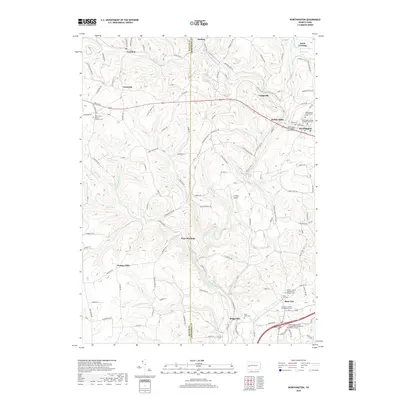
2019 Map of Worthington
USGS Topo · Published 2019About this map
Worthington and the surrounding townships of Armstrong and Butler Counties appear here in contemporary detail, shaped by the enduring courses of Buffalo Creek and its many tributaries. The landscape is defined by its deep religious roots, evidenced by the concentration of faith-based burial grounds such as Worthington United Presbyterian Cem and Buffalo United Presbyterian Church Cem. These sites, along with others like Saint Johns Roman Catholic Cem, anchor the rural crossroads of Fenelton, Coyleville, and Boggsville. Modern infrastructure, including the J T Willie Airport and the Indiana University of Pennsylvania Northpointe Regional Campus, sits alongside historic mill sites like Dennys Mills and Buffalo Mills. The map documents a classic Western Pennsylvania pattern of valley-floor settlements like West Winfield and upland ridge-line communities such as Slate Lick, connected by a dense network of local roads including State Rte 3013 and Craigsville Rd.
Find a feature on this map
135 named features on this map. Tap any name to fly to it.
Don’t see what you’re looking for? This feature index may not catch every label — zoom into the map to look around manually.
Map Details
Editions of this 2019 Worthington Map
This is the sole edition of this map. No revisions or reprints were ever made.
Other maps of this area

1900 · Kittanning
USGS Topo · 1:62,500

1902 · Kittanning
USGS Topo · 1:62,500

1907 · Freeport
USGS Topo · 1:62,500

1908 · New Kensington
USGS Topo · 1:62,500

1909 · Freeport
USGS Topo · 1:62,500

1909 · Butler
USGS Topo · 1:62,500

1910 · New Kensington
USGS Topo · 1:62,500

1911 · Butler
USGS Topo · 1:62,500

1953 · Pittsburgh
USGS Topo · 1:250,000
1953 · Curtisville
USGS Topo · 1:24,000