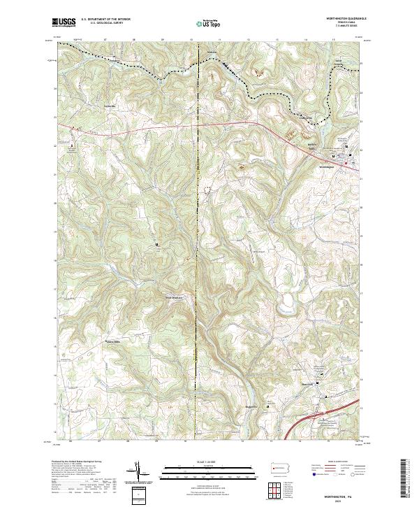
2023 Map of Worthington
USGS Topo · Published 2023About this map
Worthington and the surrounding townships of Butler and Armstrong counties are defined by the winding valley of Buffalo Creek. This area of Western Pennsylvania maintains a distinct rural character, where small clusters of homes and historic milling sites like Buffalo Mills and Dennys Mills dot the landscape. The map reveals a high concentration of burial sites that reflect the area's denominational history, including the Saint Johns Roman Catholic Cem and the Worthington Presbyterian Cem.
Find a feature on this map
107 named features on this map. Tap any name to fly to it.
Don’t see what you’re looking for? This feature index may not catch every label — zoom into the map to look around manually.
Map Details
Editions of this 2023 Worthington Map
This is the sole edition of this map. No revisions or reprints were ever made.
Other maps of this area

1900 · Kittanning
USGS Topo · 1:62,500

1902 · Kittanning
USGS Topo · 1:62,500

1907 · Freeport
USGS Topo · 1:62,500

1908 · New Kensington
USGS Topo · 1:62,500

1909 · Freeport
USGS Topo · 1:62,500

1909 · Butler
USGS Topo · 1:62,500

1910 · New Kensington
USGS Topo · 1:62,500

1911 · Butler
USGS Topo · 1:62,500

1953 · Pittsburgh
USGS Topo · 1:250,000
1953 · Curtisville
USGS Topo · 1:24,000
Featured Places
- North Buffalo Township, PA
- Worthington, PA
- West Franklin Township, PA
- Buffalo Mills, PA
- South Buffalo Township, PA