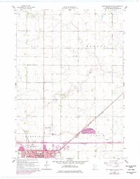
1960 Map of Worthington North
USGS Topo · Published 1977About this map
Worthington serves as the focal point of this Nobles County landscape, showcasing its mid-century growth as a regional hub. The map illustrates the convergence of two major rail lines, the Chicago and North Western and the Chicago Rock Island and Pacific, which influenced the town's industrial and residential layout. Local educational and recreational landmarks are prominently marked, including the Christian Sch, High Sch, and the Worthington Country Club. Beyond the city limits, the landscape transitions into a managed agricultural environment defined by water systems like Elk Creek, Okabena Creek, and the straight lines of the Judicial Ditch. The presence of the Worthington Municipal Airport and the County Fairground highlights the area's role as a center for commerce and community gathering during the 1960s.
Find a feature on this map
29 named features on this map. Tap any name to fly to it.
Don’t see what you’re looking for? This feature index may not catch every label — zoom into the map to look around manually.
Map Details
Editions of this 1960 Worthington North Map
3 editions found
Other maps of this area

1954 · Fairmont
USGS Topo · 1:250,000

1958 · Fairmont
USGS Topo · 1:250,000

1960 · Brewster
USGS Topo · 1:24,000

1960 · Reading
USGS Topo · 1:24,000

1960 · Bigelow
USGS Topo · 1:24,000

1960 · Worthington North
USGS Topo · 1:24,000

1960 · Worthington South
USGS Topo · 1:24,000

1960 · Round Lake
USGS Topo · 1:24,000

1970 · Dundee
USGS Topo · 1:24,000

1970 · Fulda
USGS Topo · 1:24,000