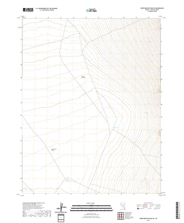
2021 Map of Worthington Peak SW
USGS Topo · Published 2021About this map
Sand Spring Valley dominates this high-desert portion of Lincoln County, characterized by its arid expanse and isolated water sources. The landscape is punctuated by ephemeral and perennial water features that were vital for survival in this dry environment, including Rose Spring in the north and the descriptively named Stinking Spring to the southeast. At the heart of the terrain lies Hecker Dry Lake, a prominent playa that serves as a focal point for the surrounding alluvial drainage patterns.
Find a feature on this map
12 named features on this map. Tap any name to fly to it.
Don’t see what you’re looking for? This feature index may not catch every label — zoom into the map to look around manually.
Map Details
Editions of this 2021 Worthington Peak SW Map
This is the sole edition of this map. No revisions or reprints were ever made.
Other maps of this area

1942 · Penoyer Valley
USGS Topo · 1:125,000

1952 · White Blotch Springs
USGS Topo · 1:62,500

1954 · Caliente
USGS Topo · 1:250,000

1959 · Caliente
USGS Topo · 1:250,000

1964 · Tempiute Mtn
USGS Topo · 1:62,500

1985 · Worthington Peak
USGS Topo · 1:24,000

1985 · McCutchen Spring
USGS Topo · 1:24,000
1985 · Quinn Canyon Springs
USGS Topo · 1:24,000

1985 · Worthington Peak SW
USGS Topo · 1:24,000
1985 · Meeker Peak
USGS Topo · 1:24,000