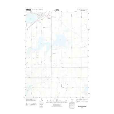
2013 Map of Worthington South
USGS Topo · Published 2013About this map
Worthington anchors the northern edge of this southwestern Minnesota landscape, situated along the shores of Okabena Lake. The geography is defined by the Coteau des Prairies, a high glacial plateau that rises above the surrounding plains. To the south of the city, the land transitions into a pattern of scattered prairie lakes and agricultural holdings, including Ocheda Lake, Lake Bella, and Indian Lake. Local commerce and land use are evident through named agricultural sites such as Ocheda Orchard and Nystrom Orchard.
Find a feature on this map
46 named features on this map. Tap any name to fly to it.
Don’t see what you’re looking for? This feature index may not catch every label — zoom into the map to look around manually.
Map Details
Editions of this 2013 Worthington South Map
This is the sole edition of this map. No revisions or reprints were ever made.
Other maps of this area

1954 · Fairmont
USGS Topo · 1:250,000

1958 · Fairmont
USGS Topo · 1:250,000

1960 · Brewster
USGS Topo · 1:24,000

1960 · Reading
USGS Topo · 1:24,000

1960 · Bigelow
USGS Topo · 1:24,000

1960 · Worthington North
USGS Topo · 1:24,000

1960 · Worthington South
USGS Topo · 1:24,000

1960 · Round Lake
USGS Topo · 1:24,000

1970 · Harris
USGS Topo · 1:24,000

1972 · Ocheyedan
USGS Topo · 1:24,000